Chalk
The foundation of Berkhamsted Common

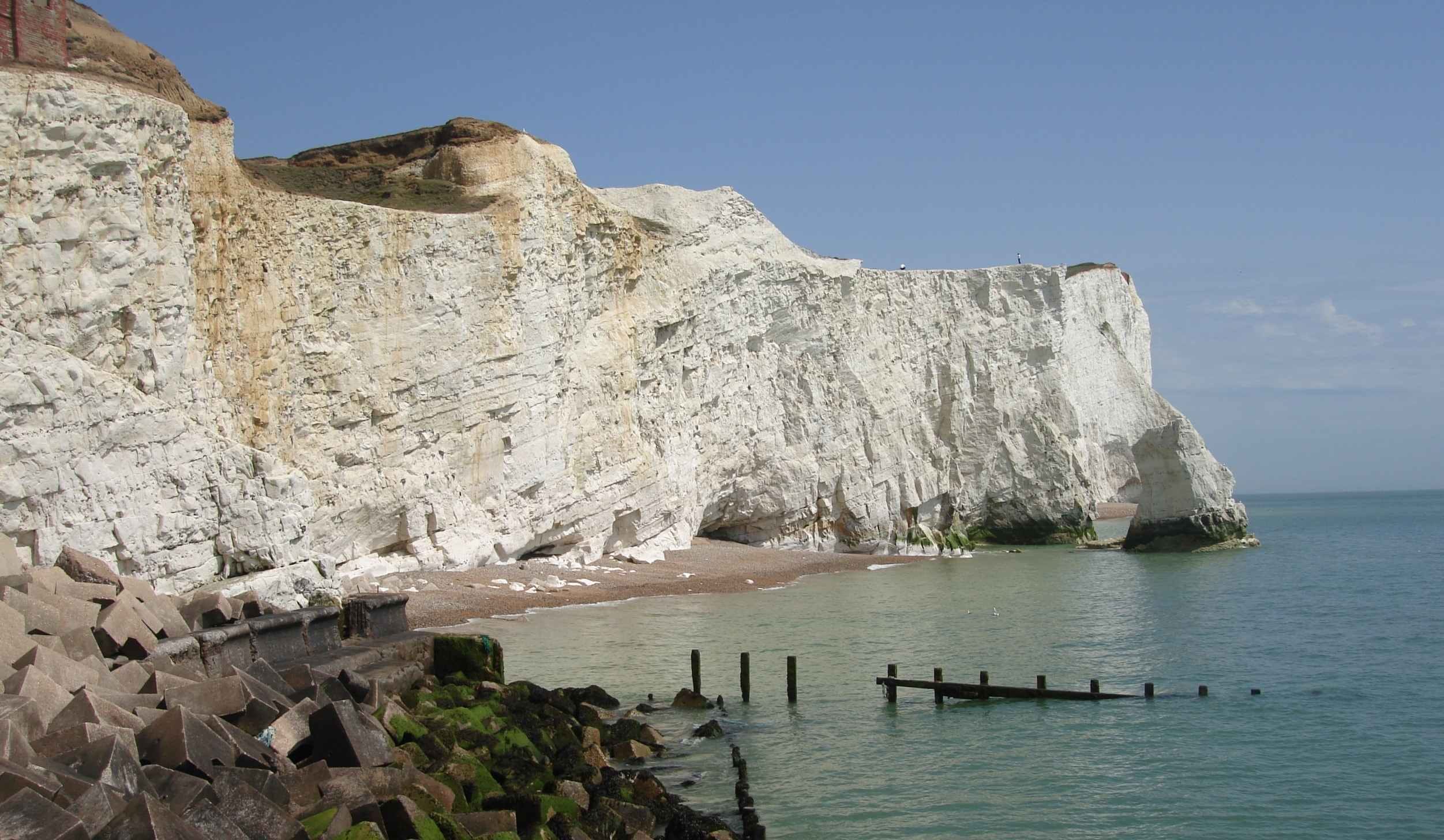
Seaford Head in East Sussex; the same rock underlies the Common. The brown staining is from traces of clay deposits above the chalk - on the Common these are much thicker
The backbone of Berkhamsted Common is chalk, the white paradoxical rock that underlies much of southern and eastern England. The Common sits on a chalk ridge, the top of which is covered with a slab of clay, like a layer of marzipan draped over a cake. On its flanks, where the ground falls away into valleys, the chalk is close to the surface, under a thin layer of soil, and is revealed by excavations, dribbling out in white stones. This bedrock of chalk largely determines the Common’s form.
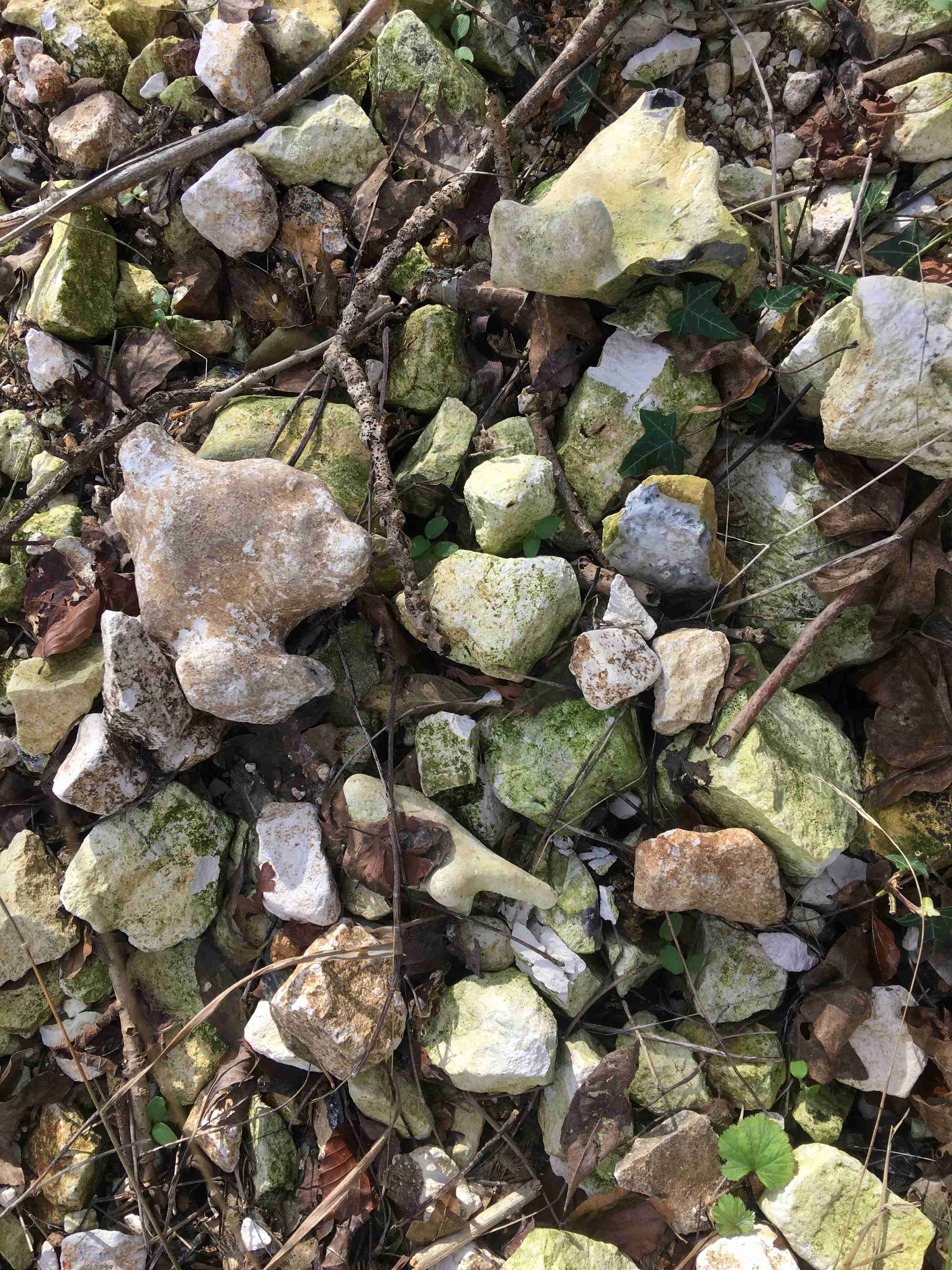
Excavated rocks on the Common; the smooth ones are flints, the lumpy angular pieces are chalk. Once above ground they rapidly acquire a green coat of algae.
I’ve long felt that the chalk is my foundation too. My maternal line comes from the chalk plains of Wiltshire. The first home I remember was built on a chalk down (chalk hills are often called downs in Southern England – not so much in the Chilterns); new built, my early encounters with the earth were trying to dig the hard dry, sharp flinty soil with a plastic spade. I’m still doing that. In my mid childhood I lived in the north Midlands where I had a precocious nostalgic longing for the chalk hills of the south, my heart lifting when we came to brightly lit chalklands on summer holidays. Always I hankered to return from ‘the Midlands that are sodden and unkind’. I have a conviction that the light is brighter, clearer and the air sweeter on the downs. My return to the south country, when I was twelve, to live under the South Downs, was a homecoming. Later, when I lived in London, the chalk was still there, lying deep under the clay, revealing itself in limescale from the tap water. We built our house in the Chilterns on a ledge cut into a chalk hillside; I sleep with a mass of it above my head; I drink the water pumped from the rocks deep below. I am of the chalk.

Kingston Hill in the South Downs. I lived below it during my teens, and to me it is the archetypal chalk hill.
Chalk, so commonplace in this part of the World, is taken for granted. We don’t pause to think what an extraordinary rock it is. It is a limestone, made of calcium carbonate. There are plenty of limestone deposits around the world, from many eras, coloured cream to dark grey. Chalk is white. Dazzling white. Sometimes it is a slightly grey, or even iron stained – but generally it is white. It is a very pure calcium carbonate, largely formed of tiny calcite crystals, the remnants of once living plankton. These particles come from the disintegration of the hard parts of Coccolithophoridae, single celled golden-brown algae, which lived in a warm shallow sea at a time when the Earth had a ‘greenhouse’ climate, and dinosaurs were still around. After the plankton was eaten by larger sea creatures, the ‘skeletons’ were defecated, falling like snow to the sea floor, where it accumulated for tens of millions of years. It is strange to think that the source of millions of cubic metres of hard mineral, part of the earth’s surface, originated in tiny, vulnerable, living things.
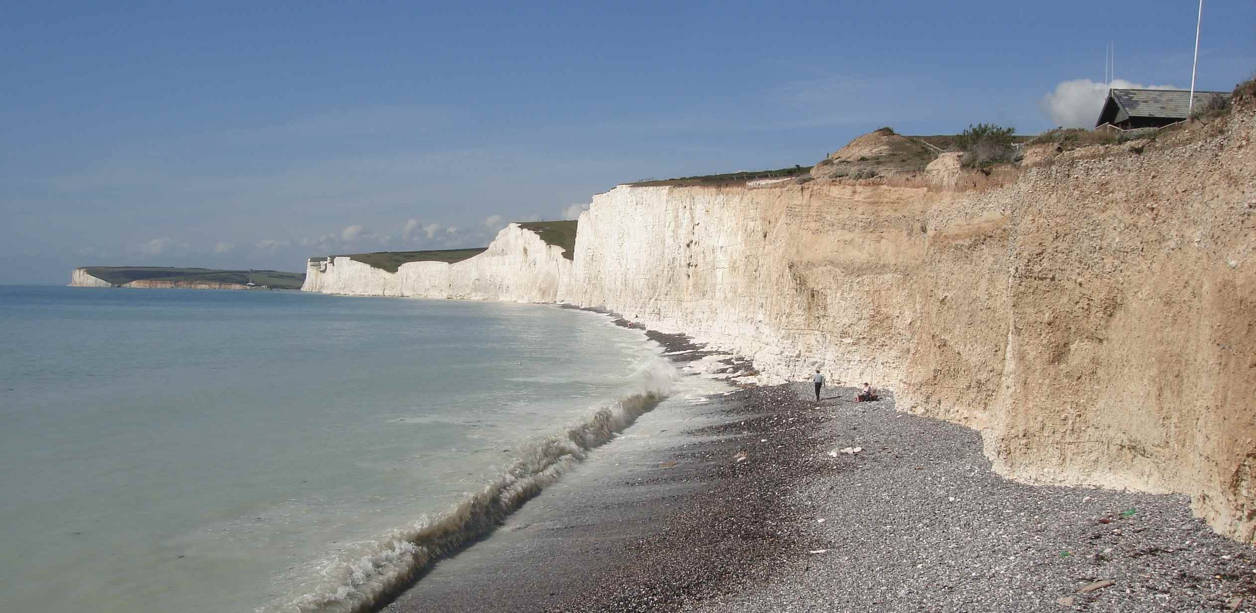
The Severn Sisters and Seaford Head from Birling Gap in East Sussex. A slice through the chalkland. It is eroding very quickly; every time I visit more has fallen. It is a popular place for Asian tourists to visit, to see the famous White Cliffs.
I first learnt about the chalk in a school in the middle of the South Downs. Outside the window I could see the chalk cliffs of old quarries on the valley side. Smoke from a cement works, burning chalk, blew across in an evil smelling mist. We learnt the names for the layers of chalk: at the top, upper chalk; next, a narrow band of chalk rock; then, middle chalk; followed by a harder layer called Melbourn rock, and at the bottom lower chalk with clay. Decades later, researching the Common, I discover that geologists have renamed the chalk. To my delight the new names are of beloved places. The chalk that underlies the Common is the Lewes Nodular and Seaford formations. Along the edge of the Common, more or less where the boundary bank was built (a coincidence, or not?) there is a narrow band of slightly harder chalk rock, explained by geologists as a compacted sea bed.
You can go to the Sussex Coast to see what is under our feet. Standing near the cliff at Birling Gap (not too close – it crumbles easily) you can look up at hundreds of feet of white rock, lined through with seams of grey flint nodules. This is what is under the Common.
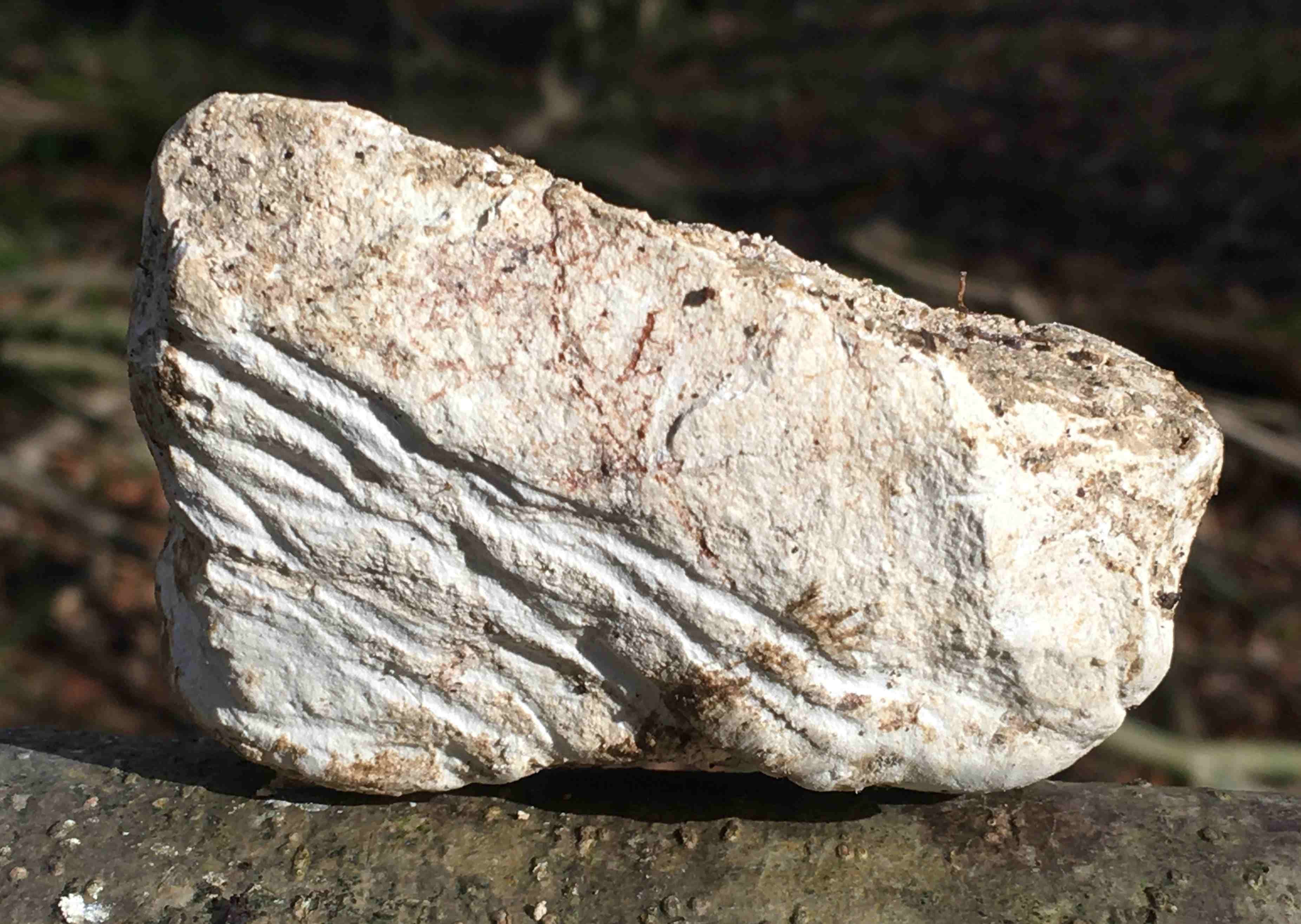
A lump of chalk on the Common, scored by badger claws
Chalk is soft to rub, wetted it feels soapy, and whitens your hands. Dried, the rubbed off chalk forms a fine white dust, which coats your shoes when walking in dry weather, and forms a sticky slick in wet conditions. It is easily dug by badgers, who like to make dry cosy homes in it. For humans it is a poor building stone, and more useful as a material to fertilise fields, and make lime and cement. It is fairly uniform, like a cheese, and is easy to cut, but it crumbles readily, especially when water gets in and freezes. It is slowly dissolved by rainwater. You would think it could hardly last for long on the Earth’s surface. Yet it forms most of the highest hills in southern England, and tall vertical sea cliffs
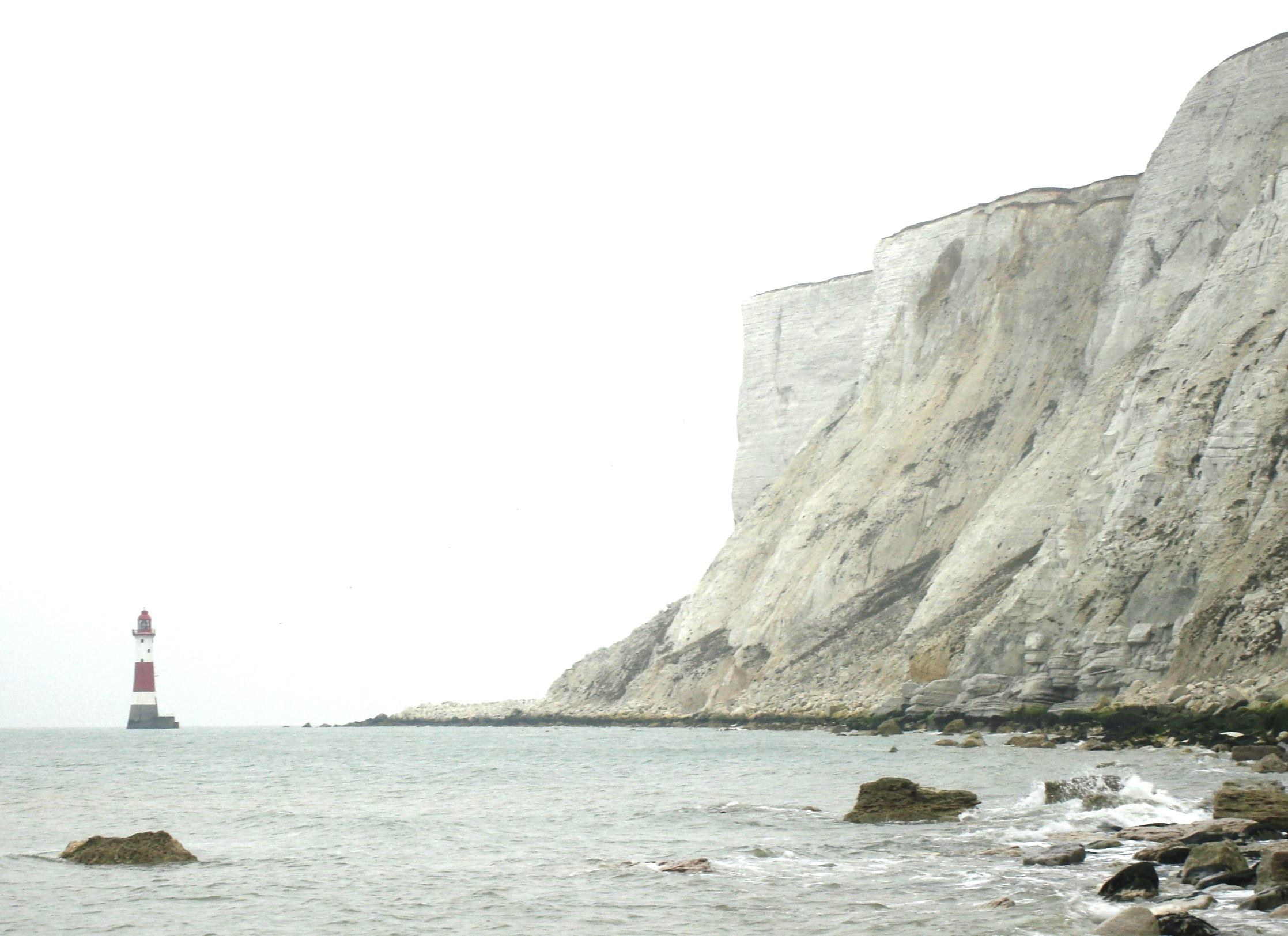
Beachy Head in East Sussex, where the the highest part of the chalk meets the sea. These cliffs are 162m/531 feet high. The chalk is maybe about 300m thick at Berkhamsted Common. This cliff exposes more or less all the chalk layers - the base of the cliff is the base of the chalk. The top layers of the chalk are missing in England - this includes the thin layer of clay which marks the end of the Cretaceous period, laid down in the days after the dinosaur-exterminating asteroid hit the Earth, about 66 million years ago. You can see that layer in a chalk cliff in Denmark.
The chalk landscape, such as the Common’s, is dry, with little surface water. But there are plenty of signs of water erosion; long sinuous valleys, short gullies, hogs-back ridges. Water is there, but not on the surface. It soaks down through the porous chalk, which holds it at the bottom like a sponge. Sometimes the water level in the rock rises to the surface, fluctuating with rainfall, to appear in clear springs, never freezing, running off into streams too small for their valleys, erratic in their flow; bournes and chalk streams, feeding folklore and fishermen’s dreams.
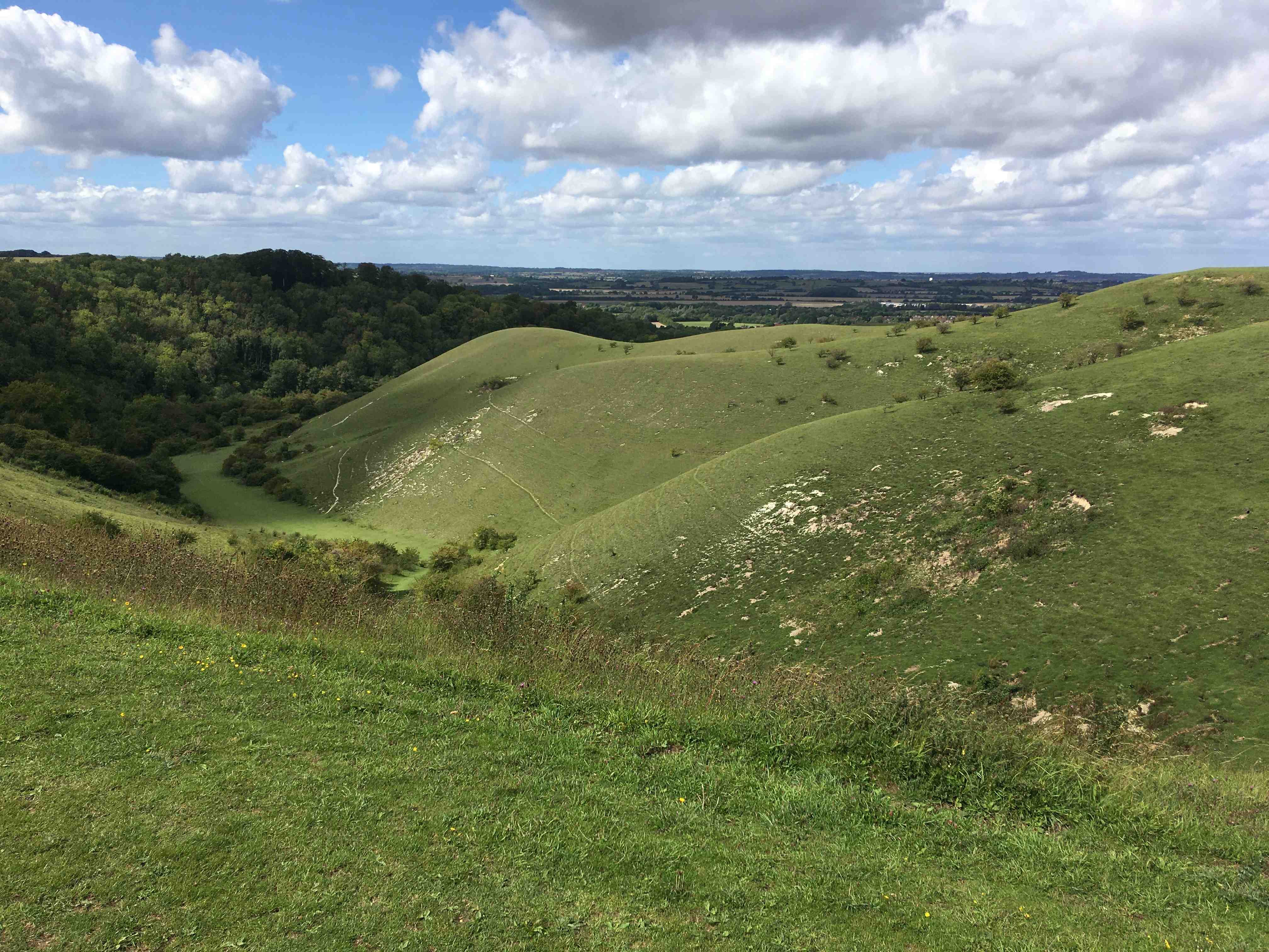
Barton Hills, Bedfordshire: This is a lovely chalk land valley near the eastern end of the Chilterns. The hills are covered with a thin flowery turf, which is easily scraped away by feet and animal diggings to reveal the chalk. The upper part of this valley is a typical ‘dry valley’, but lower down, there is an unusual magical spring of clear water.
The Common perches on the north west rim of what geologists and geographers call the London basin. The north and south boundaries of the basin are defined by two ranges of chalk hills - the North Downs (confusingly to the south) and the Chilterns in the North. The Chilterns are a tilted plateau of chalk, capped with slabs of clay. They are part of a long line of high ground that runs from Wiltshire to Norfolk, becoming lower and flatter to the east. They lie between where the Thames cuts through the chalk, south of Oxford, to somewhere in northeast Hertfordshire – some say the Hitchin gap, but I think the change in landscape is at Royston where the end of the ‘downland’ slips down into Cambridgeshire.
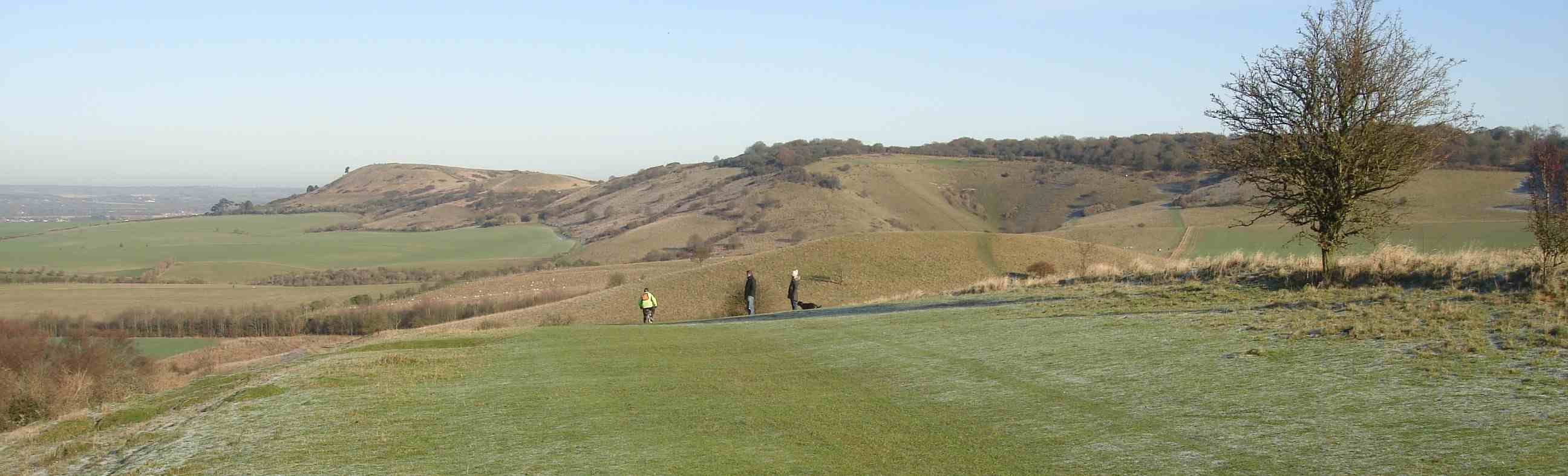
Ivinghoe Beacon from Pitstone Hill: The scarp edge of the Chilterns, facing north west over Aylesbury Vale.
The edge, with steep ‘scarp’ slopes, faces north west, out across the clay vale that is the start of the Midlands The scarp is like a sloping cliff, thin soiled, with the chalk revealed in scars from quarries and erosion, or – at Whipsnade – a lion shape cut in the turf. The other slope – the dip slope – tilts at a few degrees south eastwards to eventually disappear under the clays and sands that fill the London basin. It is patchily covered with clay. The Chilterns are broken up into blocks, like teeth, by valleys that cut across the grain, drained by small rivers, useful passageways for transport and sites for settlements. The Common is on the edge of one of these blocks, draping off the tops and along the higher slopes of the valley side.
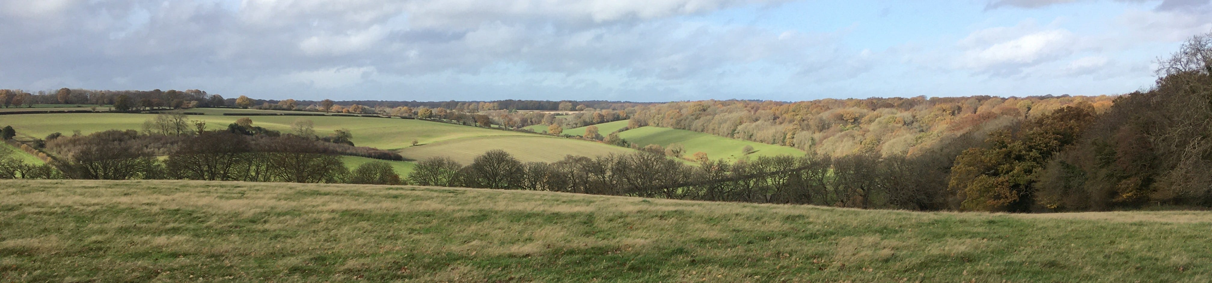
Berkhamsted Common (on the right) on the Chiltern plateau, its wooded edge running along the sides of a dry valley. The fields were part of the medieval deer park of the castle.
Wow, this is fascinating!
My excavation in Wigginton has revealed a 10m deep cap of clay on top of the chalk - we are nearly 200m above sea level. Yet Ivinghoe Beacon (which is about the same height) has virtually no clay cap. I’m not sure why this is? It’s very ‘grounding’ to think about what’s beneath our feet and how we are connected to the wider landscape.