Attack on the Frith
Attempts at the enclosure of Berkhamsted Common in the years before the English Civil War

A note: In the seventeenth century the part of the Common under discussion was called Berkhamsted Frith, or the Frith. I will write more about this on another occasion.
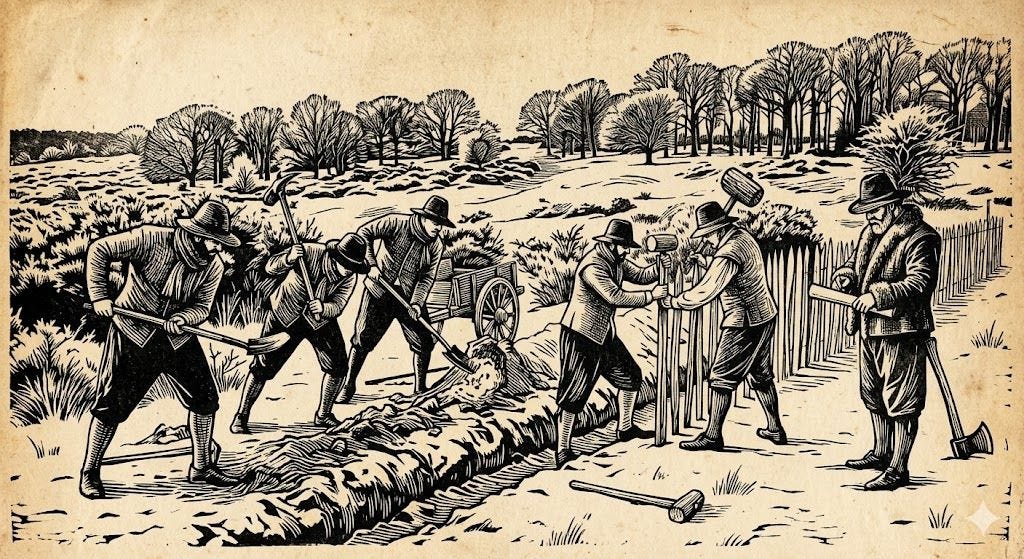
An AI generated illustration of the fence being erected on Berkhamsted Common in November 1639. I instructed Gemini to make this in the style of a seventeenth century woodcut, which it has not got right; I think it is more like an early twentieth century book illustration.
I’m immersed in the seventeenth century, in the decades that preceded the first English Civil War, that started in 1642. These days this is treated as part of the Wars of the Three Kingdoms (1639-1653). In Europe the Thirty Years War was going on between 1618 and 1648.
It was a strange time, and I struggle to understand it. It feels distant, yet with elements of recognisable modernity, unlike medieval history. In the background, as I read about the local concerns of the Berkhamsted area, I am aware that it was a time of great upheaval, when ‘the World was turned upside down’. Berkhamsted was not isolated; it was royal lands, in a Parliamentarian county, on one of the main roads out of London. Men who had fought the ‘Turks’ were turning up in Berkhamsted High Street, seeking alms. It was a hard time economically – the Little Ice Age was taking hold, with erratic weather, challenging to an agricultural economy. It was a time of new politics and new ideas. The ‘ordinary man’ was gaining in confidence and power. The people of Berkhamsted, Northchurch and the nearby villages were far from passive - they were active in defending their interests and those of their community, as they struggled to solve difficult problems.
Berkhamsted Common’s story is contained in documents held in various archives. I would struggle to interpret them myself, not least because of the difficulty of reading 17th century handwriting (I’m using AI to help me with this). However, I can follow in the footsteps of talented historians and archive explorers. The basic research was carried out by Henry Harrod, in 1868, for the Smith v Brownlow case. The court papers for that case tell this story of the Common. This was followed by Whybrow’s detailed account in his book in 1932. Heather Falvey then filled in more information and analysis in her dissertation and paper in 2001.
Sometimes in the reading I lose touch with the Common.
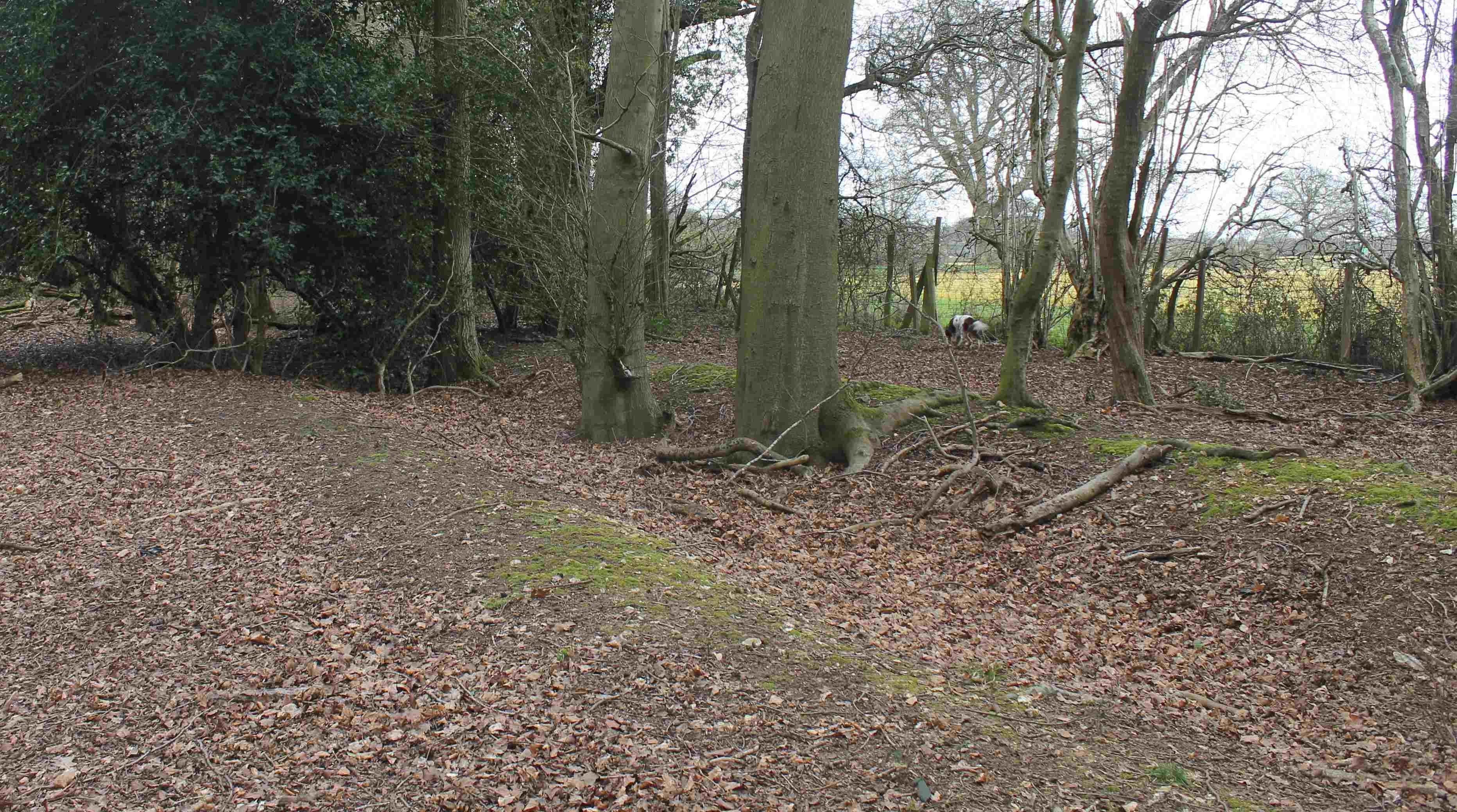
Walking the boundary, near Coldharbour Farm. The banks are the enclosure banks made in 1619. Here the boundary appears to have drifted out into the field.
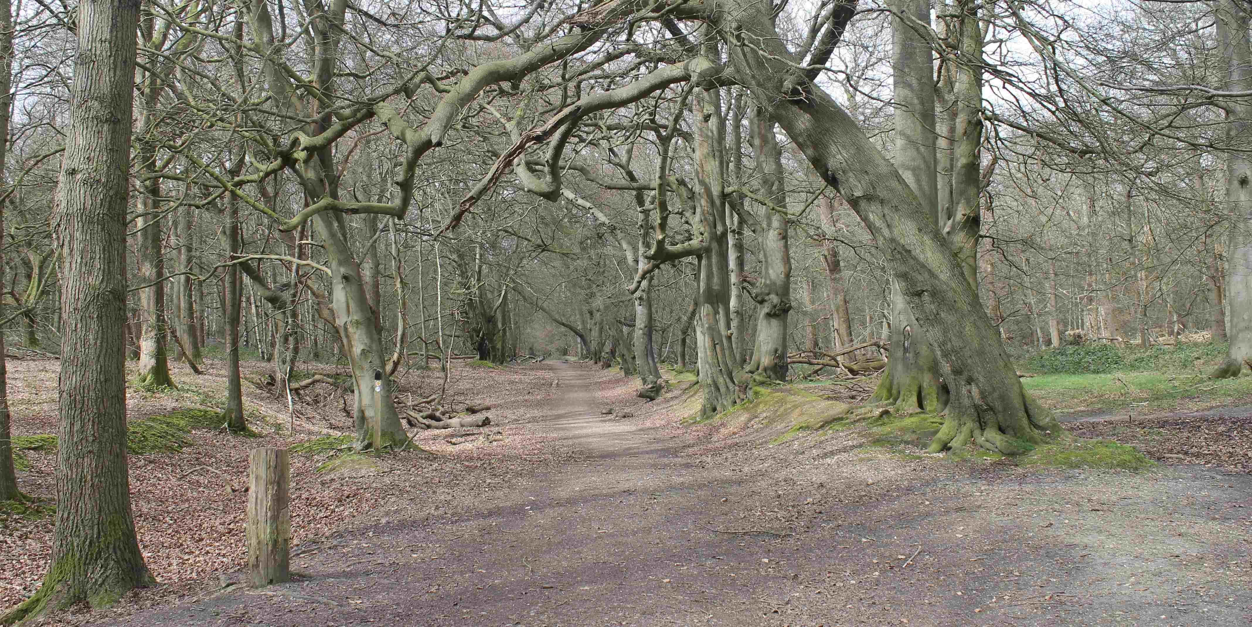
Yesterday I walked part of the boundary with my friend Joanna and her dog (who started out white and brown, and finished brown and white). The boundary we followed was made in the 17th century, and we were largely on the same route as that taken by a Mr James Moseley on 30th November 1639. Perhaps he was on horseback, perhaps he too had a white/brown dog with him. The banks and ditches he saw being made are still there. At times we had to scramble through the undergrowth to find them, and parts of them have disappeared under later roads. He would have seen some of them topped with a new wooden paling fence, and some with hedging, maybe interplanted with young beech trees. The pale went within a few years, but there are successor wooden and wire fences along the boundary, trees and bushes, the remnants of long ago laid hedges, and a few very large ancient beech trees topping the banks.
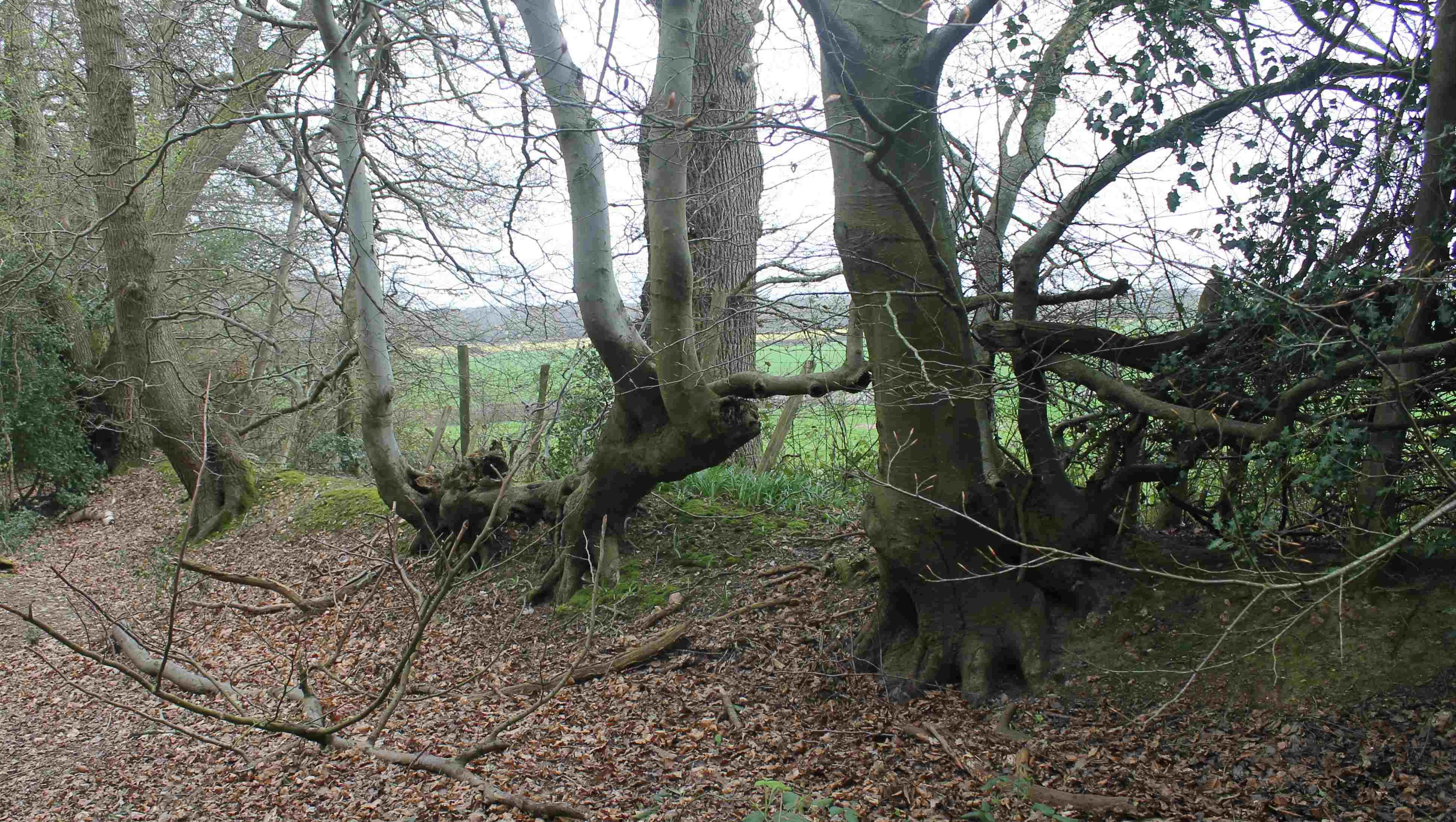
A grown- out hornbeam hedge on top of the boundary bank. The horizontal contorted trunks were formed when the hedge was laid. Since barbed wire fencing was introduced a stock proof hedge is no longer needed, and the hedge plants have resumed their natural growth as trees.
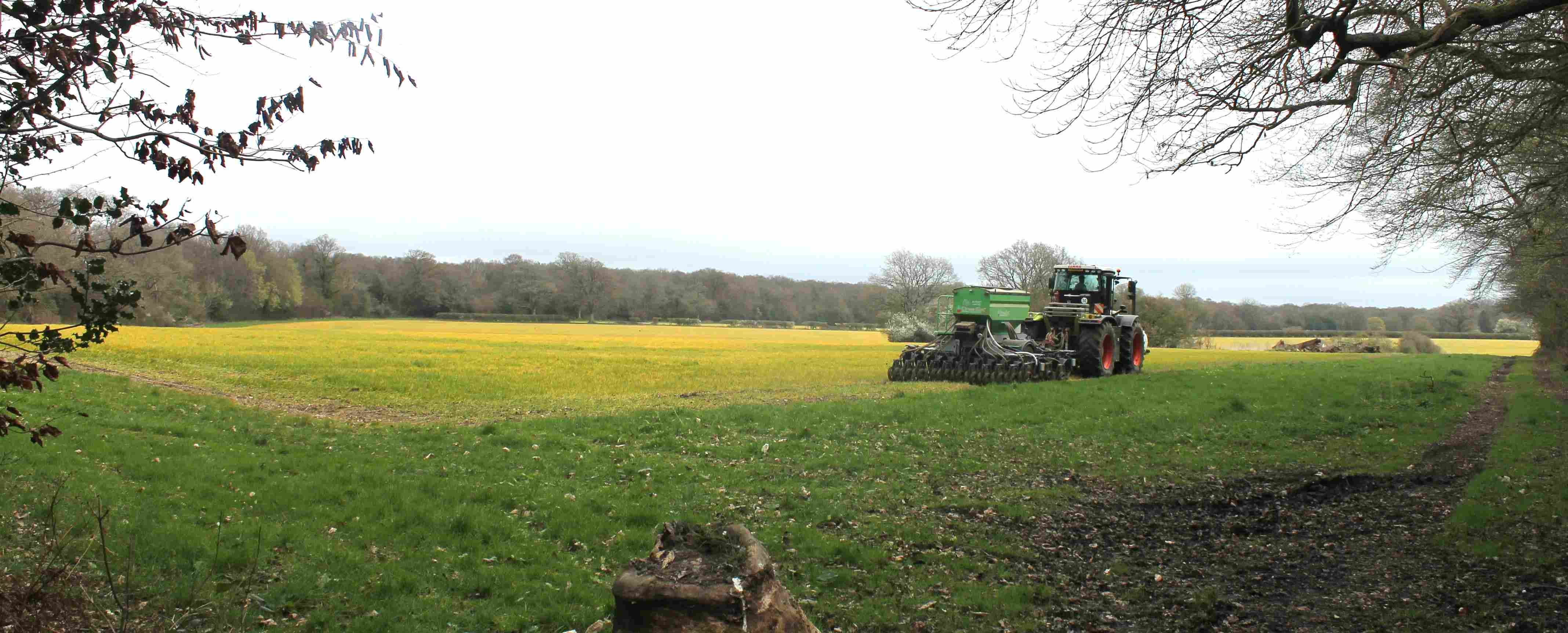
The Duchy of Cornwall (the then-owner of the Common) made two large enclosures on the Common in the early 17th century. The first was made in 1619. This cast a curved boundary bank and fence across the Common, from near Brickkiln cottage towards Hill Farm. This brought about 300 acres into the then castle park. This boundary is still the edge of the Common, on the inside of the ‘hook’, or ‘bow’ (the field inside the corner is called ‘Bow Field’). The land to the south of the boundary is farmland. Yesterday it was being sown using a remarkable all in one sowing/cultivating machine, which minimises disturbance to the soil. It would have astonished the farmer’s predecessors, labouring with oxen over this ‘cold and squeezy’ land. However, it may not remain as farmland for much longer; the National Trust has plans to build a new visitors’ centre, with a large car park, in these fields.
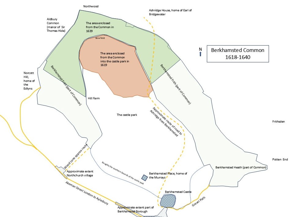
My map of the seventeenth century Common. The brown area is the successful 1619 enclosure, and the darker green area is the failed 1639 enclosure. The yellow roads are some of the roads that existed in the seventeenth century - there were other routes to and across the Common.
There are two parallel banks along the inside of the ‘bow’ of the Common. One is the boundary, with a fence and/or hedge, and the other is about 8 to 10 metres inside the Common, leaving a flat space in between. I have not found records to explain this, but I think this may be to accommodate a re-routed road that used to run across the unenclosed Common, which was itself replaced in the early 19th century by the modern ‘New Road’. I wonder too if these ‘double hedged’ routes were made to enable commoners to move animals between the two ends of the Common left open after enclosure.
Some local people, particularly the farmers who used their commoning rights, objected to the enclosures. When their words had no effect, they turned to fence breaking. On the 3 July 1620 a large number of people gathered to remove the pale (the fence), an event the authorities characterised as a ‘riot’, as authorities so often describe large gatherings of people doing things they do not approve of. After imprisonment and legal proceedings against many men and women, a deal was struck that the enclosure would be allowed to stand. The objectors claimed later that a promise was made that there would be no more enclosures.
Farming inside the ‘bow’ of the Common - the continuous line of trees in the background is the edge of the Common. The wide grassy margin round the field is a longstanding feature of fields in the area. Defoe noticed it in the early 18th century, as did a surveyor a few decades later, who thought it a waste of land.
This first enclosure was in James I’s reign, and seems mainly to have been to enlarge the castle park. However, as his son Charles I’s reign proceeded, we are always told, the King became more money grasping (the Stuarts were always short of funds) and autocratic. The Duchy was very active in looking for opportunities to make money for him. Towards the end of the 1630s the castle park was turned into farmland. This suited both the Duchy, and Mrs Murray, who rented it. The Duchy received an annual rent (which it would not have done from the Common), and Mrs Murray could sublet it. Mrs Murray lived at the mansion near the castle, and was the widow of Charles’ tutor; the Murrays were personally close to the King. If they wanted something, like more land, they asked the King, and got it.
In 1639 the Duchy returned to Berkhamsted Common. This time the plan was to extend the ex-park farmland by cutting a large slice across the Common, leaving two severed ends for the commoners. The area enclosed would be about 400 acres. Despite renewed objections by local landowners (led again by William Edlyn of Norcott Hill) surveyors were commissioned and instructions given to make the enclosure.
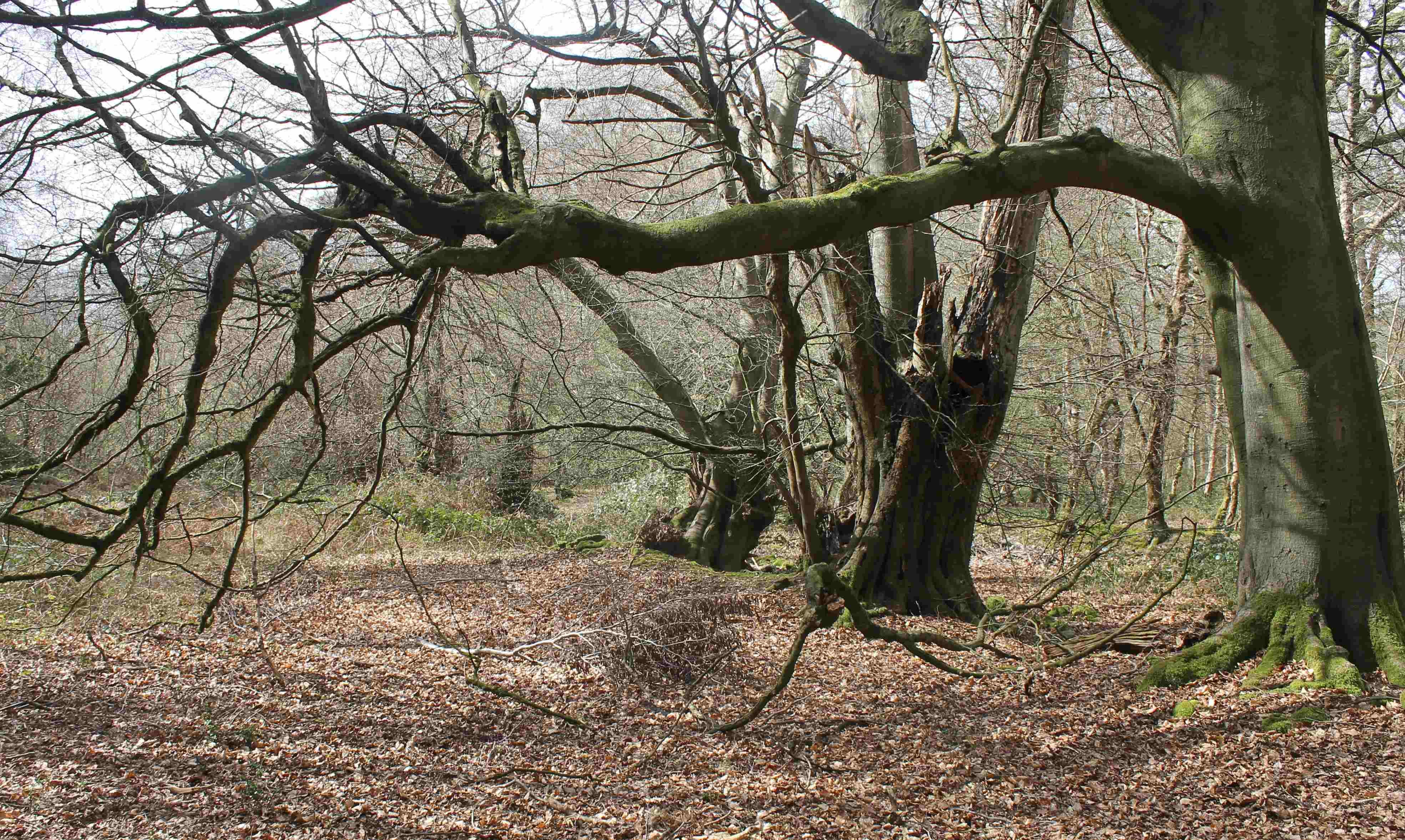
The boundary between Berkhamsted and Aldbury Commons, topped with ancient trees. The two commons were closely connected - Aldbury people claimed rights of common on Berkhamsted Common, and some were arrested in the ‘riot’. The boundary may not have been well defined until the seventeenth century, as work on laying out this part of the enclosure had to stop whilst it was agreed with local old men where it lay.
There is a letter in the Ashridge Papers in the Hertfordshire Archives that gives an eyewitness account.
It is dated 1 December 1639, and was addressed to the Earl of Bridgewater. This was the first Earl of Bridgewater, who had inherited Ashridge House and surrounding lands from his father, who had been James I’s Lord Chancellor. The Earl was evidently concerned about what was happening on the Common on two counts; one was that there was the danger of encroachment onto his own adjoining land, and the other that his own rights of common were being affected. He took legal advice about this, seeking out evidence that he held, by succession, the rights to common granted to Ashridge College in the thirteenth century. His tenants made use of these common rights.
The boundary between Berkhamsted Common, on the left, and Ashridge, on the right. The wood to the right is now called Thunderdell Wood; it was called Northwood in the sixteenth century. The bank on the Ashridge side is particularly steep and high as if Ashridge was keen to defend its lands from encroachment. The history of the way in between has been much speculated on - it is probably the old road from Aldbury to Hemel Hempstead.
James Moseley was asked by Bridgewater to go and see what was happening and to make a report. I don’t know who Moseley was; judging from his letter he was well educated, and trained, perhaps as a land surveyor. I feel he’s a young man. He reports that the ‘surveyors’ and others had been busy on the Common since the previous week. He arrives, not far from where the lodge on the road up to Ashridge is now, and found a section of park pale and little trenches already made. He follows the pale along to Northwood corner (this is now called Thunderdell Wood), then along the boundary by Aldbury Common to Norcott Hill, and then across the Common to ‘Mr Murray’s Hedge’ (the 1618 enclosure boundary), and along that almost to the gate that goes down to Berkhamsted. Moseley is indignant – he writes “I find in the whole Circumference - a great deal of injury your Lordship will sustain besides the loss of your Common which I will make full demonstration of at my return.” He promises more information, including the names of the men who did the work. And, indeed, there is a list of the men in the archives. The work was carried out quickly; Moseley says it would be completed the day after he was there.
The 1639 enclosure line across the Northchurch Common big field. The trench and bank are still there, under the line of trees and bushes that have grown up recently, when the fields on both sides were ploughed during the twentieth century.
The local people were also incensed, and broke down the pales. The Duchy took action against the ringleaders, who were big local farmers. They were imprisoned and summoned to the House of Lords, which told everyone to go away and be peaceful. Parliament had greater concerns. A couple of years later no one was peaceful; the country was at war with itself. I guess that the pales were removed promptly – the Duchy was then in no position to enforce the enclosure. After the war there was an attempt by the Cromwell Government to sell the land, but John Edlyn (William’s son) argued that the Duchy had had no right to enclose the Common, the sale fell through, and the land fell back into the Common again.
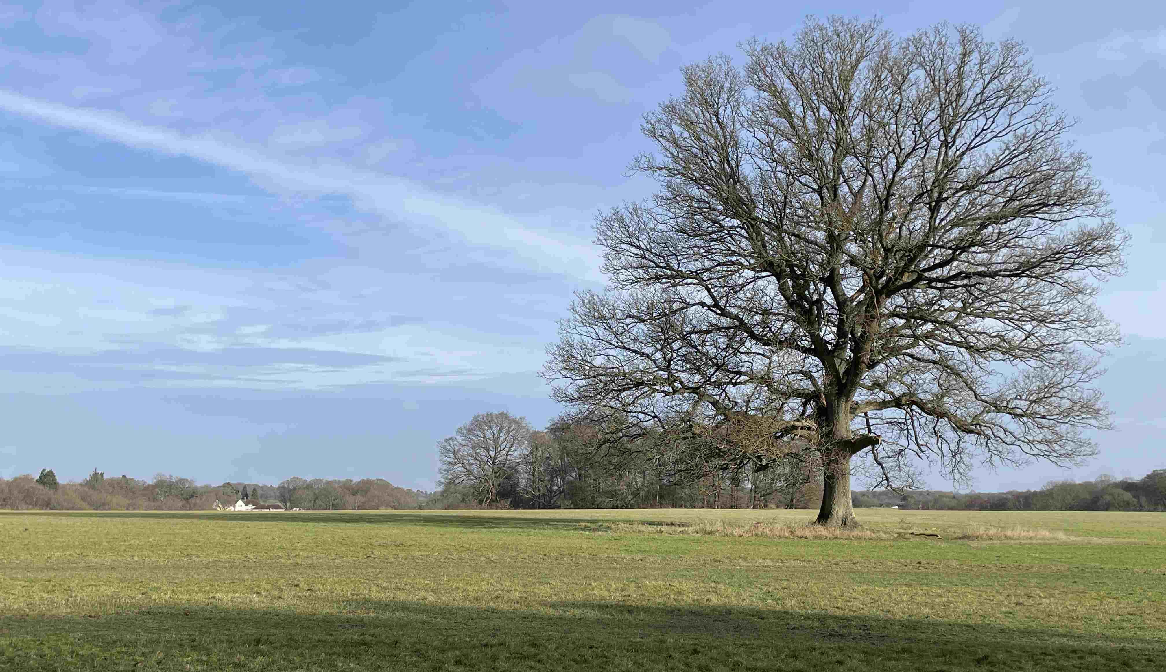
The line of the 1639 enclosure ran across the Common here, crossing in front of the oak tree, towards the white house in the distance. The bank and ditch on this stretch has largely disappeared with twentieth century ploughing (this is Cox’s field), but you can still see a shallow ditch in the unploughed ground by the tree.